The Pennine Way, granddaddy of our National Trails, celebrated its golden anniversary in 2015. More than fifty years on, it is still the finest way to explore the best of upland walking in northern Britain, and it remains both the benchmark and toughest challenge in England for any serious walker.
Some intrepid walkers will take on the trail in one go, covering 268 miles over 15-20 days, whilst others choose to experience the way in stages, one day at a time. Here, we take a look at some of the best day walks on the trail.
Looking for more walks in the area? Check out our guides to the best walks in the Peak District, Yorkshire Dales and the North York Moors.

History of the Pennine Way
Strangely, if it wasn’t for an enquiry from two young American girls to the Daily Herald in 1935, asking whether we had anything like their Appalachian Trail, the Pennine Way might never have been created.
The Herald ’s outdoor correspondent was Tom Stephenson and he seized on the idea of “a long green trail” up the backbone of England. But his hidden agenda, as he told me later, was to open up the then-forbidden moorlands of the Peak District to walkers.
Tom’s centre-page feature, proposing “a Pennine Way from the Peak to the Cheviots” appeared in the Herald on 22 June, 1935 – but it was to take another 30 years of negotiation before the Way came into existence. Thankfully, Tom was there to see it open on Malham Moor in April, 1965.
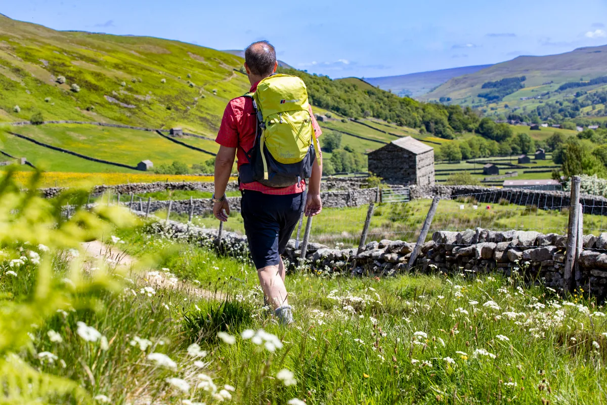
When the route was first proposed, 180 miles were on existing rights of way, leaving 70 miles to be negotiated, half of which were in the Peak District. These days, fewer people have the time to walk the entire route in one outing. Indeed, neither Tom nor Alfred Wainwright, author of its most popular guidebook, ever did. According to Pennine Way Officer Steve Westwood, most people now do the route in sections, many at weekends. “We reckon only about 1,500 people annually now do the whole route in one go,” said Steve. “But as leisure time increases, that may mean that more people are actually using the Way.”
While the Pennine Way remains an epic journey and the ultimate challenge for the long-distance walker, it can be enjoyed just as well by taking it in short sections. The following short walks showcase some of the highlights to be found along the Way.
Best day walks on the Pennine Way
Kinder Scout
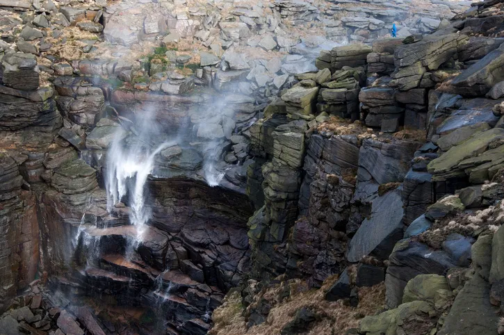
In truth, Kinder Scout is as much a spirit as a mountain. Its modest 600m summit plateau exerts an influence over the surrounding moors of the Dark Peak like no other. And its place in the long history of access to the mountains ensures that it will always remain so. So it was fitting that Tom Stephenson’s Pennine Way should start here, where the problems of moorland access had come to a head with the Mass Trespass of 24 April, 1932 – 33 years to the day before the Pennine Way finally opened in 1965.
Ramblers generally either love or hate it – there seems to be no room for compromise on Kinder Scout. Its 16-square-mile morass of peat bog, hags and groughs horrifies many, but there are just as many aficionados for whom this untamed wilderness so close to the centres of Sheffield and Manchester represents true freedom to roam.
For a taste of the best of Kinder, wind up the beautiful valley of the River Noe to the packhorse bridge at the foot of Jacob’s Ladder (pictured on page 21). This skilfully engineered path takes you on to the Kinder plateau at Kinder Low, from where a well-defined path leads round the edge towards an impressive cleft formed by Kinder Downfall, a 30m waterfall that, sadly, is often a mere trickle these days. From here you can either retrace your steps or cross the plateau on the old, original route and descend to Edale via Grindsbrook.
For the Pennine Wayfarer, the next challenge lying ahead is the inhospitable wastes of Bleaklow, summarily dismissed by Wainwright with the words: “Nobody loves Bleaklow. All who are on it are glad to get off.” Lovers of wilderness dispute the curmudgeonly old fellwanderer’s opinion, and recent paving work by the National Park and National Trust has made the Way far easier than it was in Wainwright’s day.
Malham Cove
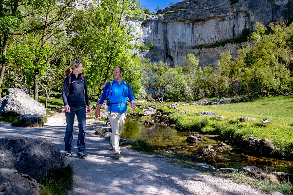
When the Pennine Wayfarer reaches Malham and its spectacular cove, you leave the soggy gritstone moors of the South Pennines behind. Ahead lie the sweet pastures and springy turf of Craven country, and the carboniferous limestone of the Yorkshire Dales. Many Wayfarers, including the sainted Wainwright, have been known to breathe a deep sigh of relief.
The awesome 90m amphitheatre formed by the cove once echoed to a thunderous waterfall higher than Niagara, as, 10,000 years ago, Ice Age meltwaters crashed over its lip. Today its vertiginous terraces are the haunt of peregrines, ravens and rock climbers, and the Wayfarer has a bird’s eye view of them as you climb the rocky staircase on the western side of the rock face.
An easy two-mile circular walk from Malham village follows the Pennine Way north up the staircase to the left of the Cove wall. On top of the cove, you find the first limestone pavement on the Way, a fretted jigsaw landscape of clints (blocks) and grykes (crevices). From the lip of the cove there is a stunning view down Airedale. In the contrasting light of early morning or late afternoon, you’ll be able to pick out the shadowy shelves of lynchets (Iron Age cultivation terraces) that line the green slopes of Shorkley Hill. After negotiating the limestone pavement, descend via a stile signposted Gordale. Crossing a field, you reach the road again at Gordale Bridge.
The section of the Way after Malham is one of the finest on the entire route. The footpath takes you past the still waters of Malham Tarn, over the shoulder of Fountains Fell and then on to one of the most distinctive mountains on the Way – shapely Pen y Ghent. From its airy, 696m summit, it’s an easy five-mile descent to Horton-in-Ribblesdale.
High Force
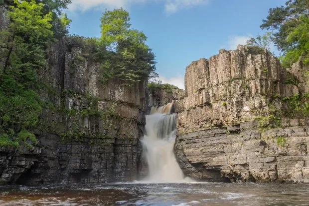
It may not be the highest, but surely the greatest of English waterfalls is High Force. The 22m cliff of clerical-grey doleritic Whin Sill rock over which the peat-stained water of the mighty Tees thunders into a dramatic, wooded amphitheatre is undoubtedly one of the highlights on the Pennine Way.
There’s a gentle introduction to High Force as you follow the river upstream from Middleton-in-Teesdale, and pass its lovely but lowly sibling, Low Force. If you catch an intoxicating whiff of gin on this stretch, it’s because you pass through dense thickets of juniper, whose dusky, blue-bloomed berries flavour that most refined of spirits.
For sheer spectacle, High Force is only matched by another water wonder: the foaming, 182m cascade of Cauldron Snout, on the Tees six miles further along the Pennine Way. If feeling fit, you can walk here from High Force. If not, park at Cronkley Bridge and follow the Way from there.
From Cauldron Snout it’s a long, seven-mile slog across boggy moorland, passing the remote farmstead of High Birkdale (home to celebrated farmer Hannah Hauxwell) and then following the Maize Beck, before you reach High Cup Nick.
High Cup Nick
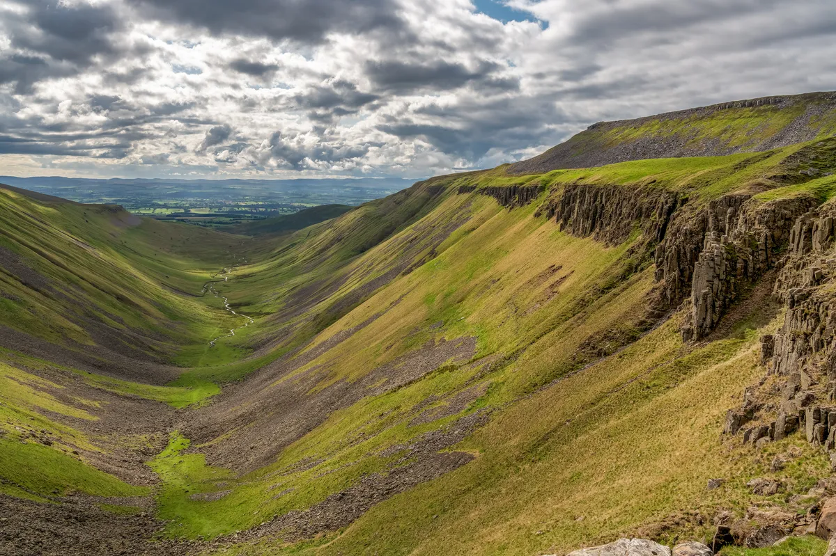
Nothing prepares the head-down, rucksack-toting Pennine Wayfarer for the moment you reach High Cup Nick, in the Cumbrian North Pennines. Having trudged across the flat limestone outcrops, old mine shafts and swampy shake holes of High Cup Plain, suddenly you find yourself teetering on the edge of an abyss.
A vast amphitheatre lined by steely grey columns of the volcanic Whin Sill rock drops vertiginously away, with the silver thread of High Cup Gill winding hundreds of feet below. The extensive views extend far out across the misty green Vale of Eden to the distant blue Lakeland hills. What a moment! High Cup Nick has been called the Grand Canyon of the Pennines and northern England’s most glorious landscape feature, and one can see why.
It’s a relatively easy eight-mile round trek from the red sandstone village of Dufton in the valley below over Dod Hill and craggy Peeping Hill via Narrowgate to reach the Nick, reversing the route of the Way. You can return by Middletongue Crag on the opposite side of the Nick to descend by Harbour Flatt and Keisley into Dufton.
Hadrian’s Wall
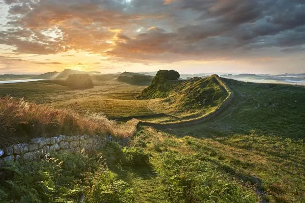
Hadrian’s Wall is one of the finest examples of Roman military architecture in Europe, still mightily impressive after nearly 2,000 years. It runs for 73 miles across the neck of England from the Tyne to the Solway. The Romans cleverly used an outcrop of volcanic Whin Sill rock for much of its length, placing the wall on top of the cliffs to give it a natural defence against attack from the north.
This six-mile walk from Haltwhistle reaches the wall at the farm on the site of the fort of Aesica after crossing Haltwhistle Common. Follow the Pennine Way and Hadrian’s Wall path signs westward alongside the wall with glorious views across the North Tyne valley towards Scotland. When you reach Turret 44B and Walltown Farm, it’s worth going a bit further to cross Walltown Crags to the flooded Walltown Quarry and the ruins of Thirlwall Castle. Retrace your steps to return to Haltwhistle via Lowtown.
From Walltown Crags, the Way follows some of the best preserved parts of the wall for eight miles. Highlights include Cawfields Crags, the highest point of the wall at Whinshields Crags, Peel Crags, past Crag Lough and Hotbank Crags.
It leaves the wall heading for the conifers of Wark Forest at Rapishaw Gap, but if you want to inspect the best-preserved Roman fort in Britain, head half a mile eastwards to Housesteads.
As you descend into the quiet border village of Kirk Yetholm, having reached the end of the way, you might be forgiven for asking: “Was it all worth it?” According to Chris Sainty, former secretary of the Pennine Way Association, who has walked the way an incredible nine times, the answer is simple: “The combination of diverse landscapes along the route; seasonal and climatic variations, together with the personal physical and mental experience, makes every visit unique. The landscape you walk through, the highs and lows (topographically, physically and psychologically) and the people you meet on the way will make the Pennine Way an experience you are unlikely to forget.”
Langdon Beck
Cronkley Scar, Falcon Clints, Whiddybank Fell, Cauldron Snout. The names have a hard-edged musicality that perfectly echoes the harsh, compelling beauty of the landscape. The huge national nature reserve of Moor House-Upper Teesdale, more than 7,000 hectares in size, is as bleak as any part of England.
Winter lingers in the high valleys long after it has melted elsewhere. Living is hard, yet the hardiest not only survive, they refuse to move away. Among the toughest are the black grouse.
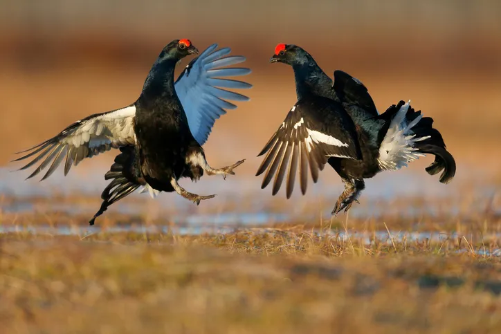
The male black grouse is an impressive fellow, and he knows it. He displays his iridescent black plumage – enhanced by a forked tail, white rump and red eyebrows – to attract females and deter rivals during the springtime lek. In decline throughout the British Isles, this large game bird hangs on in parts of Scotland, Wales and the North Pennines, though its reluctance to move beyond its territory means that the small, local populations remain isolated from each other. The Upper Teesdale flock tends to concentrate in the fields around Langdon Beck and be seen along a short stretch of the Pennine Way.
Muker to Crackpot Hall
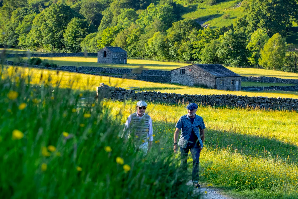
Yearning for wide open spaces? This wonderful high-level walk meanders past a storied ruin and ends at an attractive waterfall in a little-visited, yet glorious, pocket of the Yorkshire Dales.
The walk starts in the little village of Muker in the heart of Swaledale, a lush green valley with a patchwork of tiny fields and barns. This has never been one of the more popular tourist dales, but our walk takes in the area at its best and most dramatic. Take the little lane that heads north from the main road near the church. This eventually leads to a stony path zig-zagging up the hill with a view to the road snaking across Buttertubs Pass. Just before reaching the top of the hill, turn right to join the Pennine Way.
Malham Tarn
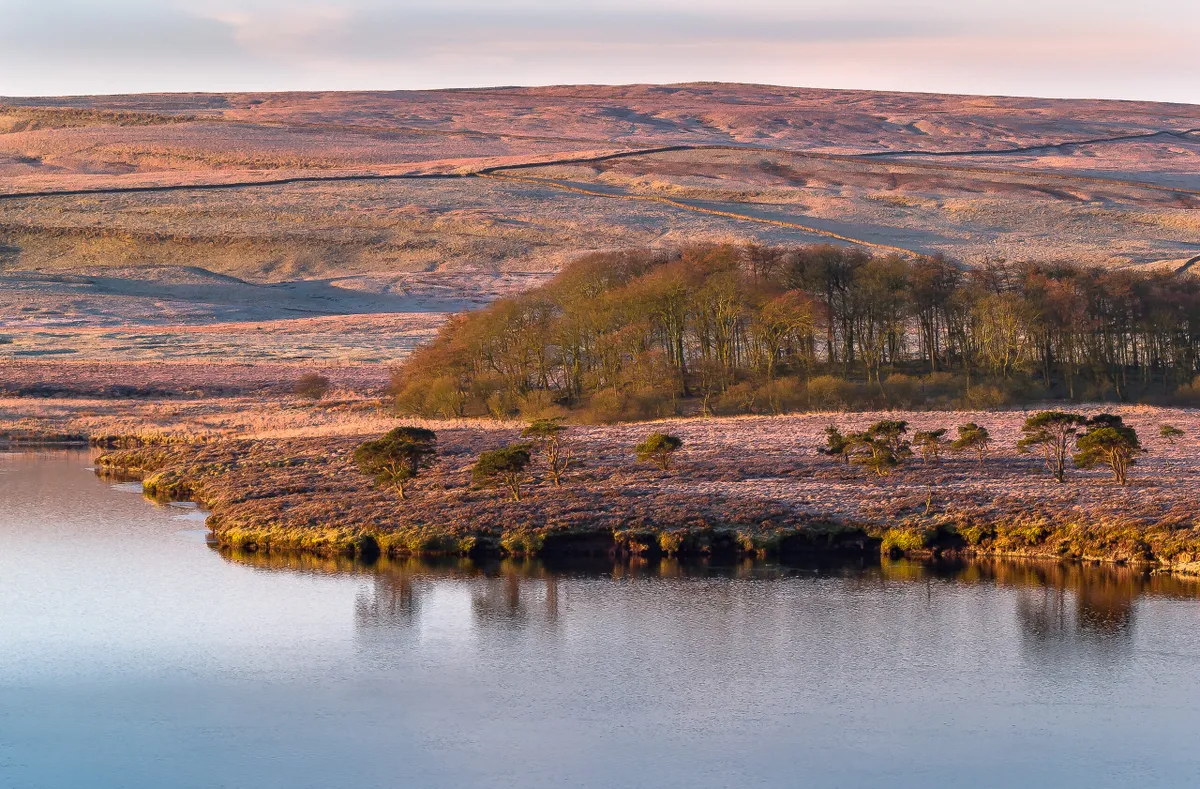
This short section of the Pennine Way skirts the shores of Malham Tarn beneath the looming cliffs of Great Close Scar offers ramblers a chance to experience a variety of habitats, from craggy limestone bluffs, to thick forest, peatland and a wildlife-rich upland lake.
At 377 metres above sea level, Malham Tarn is the highest marl (calcium carbonate or lime-rich mud) lake in Britain.
Keld to Tan Hill
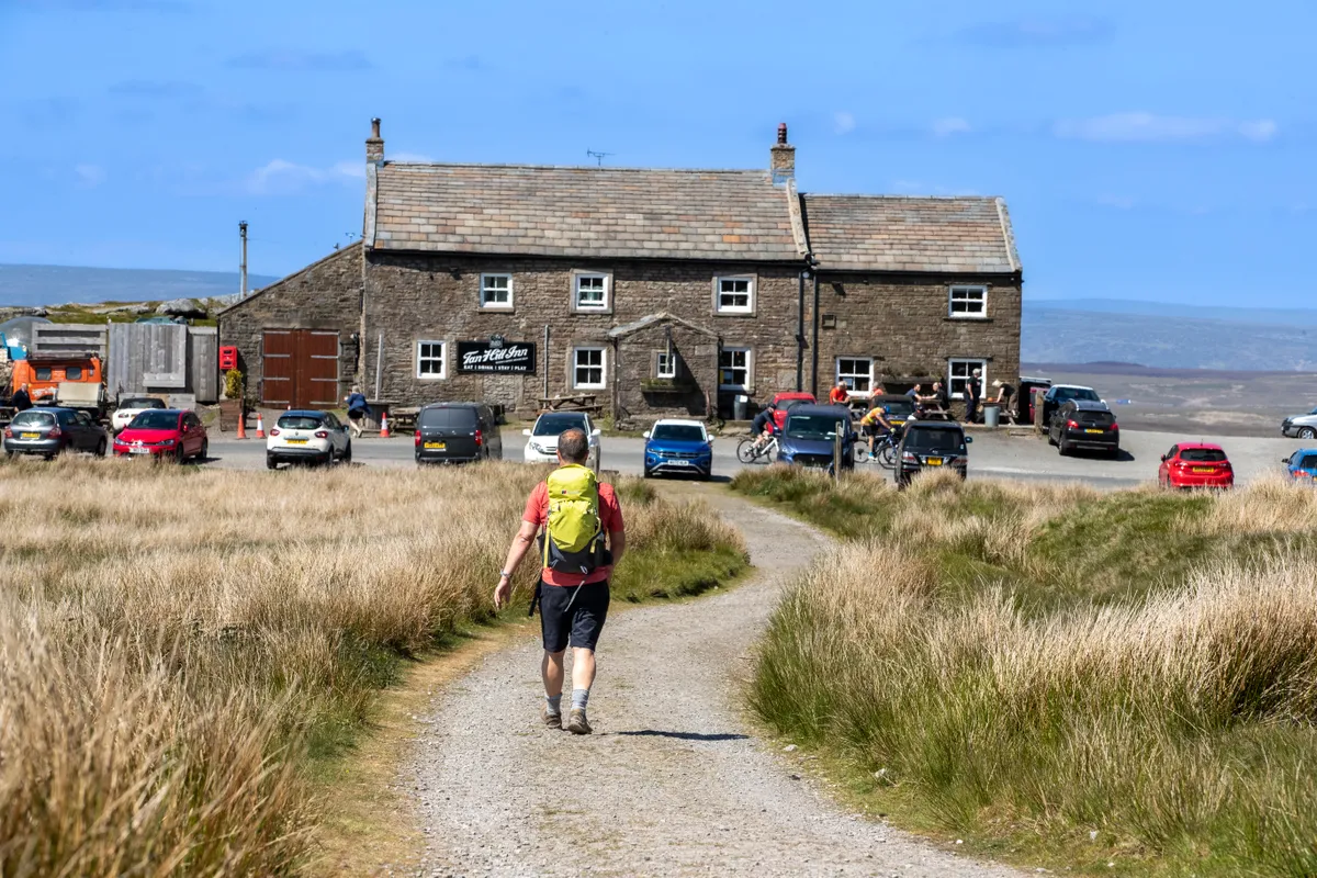
On a lonely site high in the Yorkshire Dales stands a unique and historic place. With its exposed beams, stone-flagged floor and welcoming fire, the Tan Hill Inn, Britain’s highest public house at 528m (1,732ft), is a place where walkers brush shoulders with inquisitive tourists.
This walk takes you to the head of Arkengarthdale on the edge of Swaledale, where winds rush across moorland, and where you can stop at a warm pub to refuel or rest your weary head.
