Here is our guide to the UK's footpaths and why so many are under threat.
Footpath facts
- England and Wales has 180,000 miles of public rights of way in its network
- Britain has 91,000 miles of footpaths, 20,000 miles of bridleways, 2,300 miles of byways and 3,700 miles of restricted byways
Why are Britain's footpaths under threat?

Thousands of footpaths – 9% of the network in England and Wales – are impassable, blocked off or effectively unusable. The Big Pathwatch Survey by the Ramblers in 2016 identified 59,000 problems, ranging from routes blocked by barbed wire and electric fences, to broken stiles and dense, impenetrable undergrowth. The Country Land and Business Association (CLA), however, says that farmers and landowners feel the path network often does them few favours and takes no account of modern agriculture.
More related content:
“There is a risk that fewer people will go walking. If that happens and people don’t value their paths close to home, then they will shut down ” Kate Ashbrook, general secretary of the Open Spaces Society (OSS)
[highlight-box]More related content:
- The National Trust campaigns to restore the UK’s footpaths
- Restore our missing footpaths, says John Craven
- Campaign aims to raise £250,000 to repair Snowdonia’s footpaths
What's the cause?
1. Landowner obstruction
Landowners opposing public access to their land remains a common problem, according to both the Ramblers and the Open Spaces Society.
2. Local Authority cuts
Between 2012-2015, 70% of local authorities had cut their rights of way budgets. 41% of authorities reduced them by over 20%.
3. Outdated footpath network
“The system is chaotic and not designed for modern land use, machinery and livestock,” says the CLA’s Andrew Gillett. “Centuries-old paths run straight through farmyard, raising health and safety issues.” The Ramblers’ Stephen Russell sees it as educative: “This is an excellent way for people to connect to what farmers do and how they shape the landscape.”
4. Permissive paths disappearing
Both walkers and landowners say that this is directly linked to the end of Agri-Environment schemes in 2010, which paid farmers for opening up footpaths. “Many farmers saw the benefit of a small payment and the benefit to the local community [of a path],” says Gillett (CLA). “In the absence of support from Government, that decision becomes harder.”
Right to roam - the definitive map

This is the legal record of public rights of way. A clause in right-to-roam legislation introduced in 2000 stated that pre-1949 paths must be recorded on the definitive map by 2026 to continue to carry public rights, otherwise they will be extinguished. January 2026 seems a long way off but access campaigners say the research required means the date looms large.
“We are hugely in favour of the 2026 cut-off point,” says Gillett of the CLA. “There has to be some certainty when people buy property. At the moment, there is no way of knowing if there is a 200-year-old path through your land that might get revived.”
“These are highways in law,” says Kate Ashbrook of the Open Spaces Society. “They are public routes but if we don’t register them we lose them. I accept that many of them are now under concrete but they can be diverted. The surface belongs to the public.”

How to save a footpath
Action by authorities
The OSS’s Kate Ashbrook says that illegal blockages must be swiftly dealt with. “If a farmer is planting crops across a path, then the council must issue a notice. Councils have to be tough and not be strung along.”
Volunteer to help maintain a footpath
“We can’t suggest you just take matters into your own hands,” says Stephen Russell of the Ramblers. “If you want to help out with paths, contact your local authority. Some of these have voluntary networks of local people who develop relationships with landowners and are overseen by local authorities.” The Ramblers and other bodies such as the AONB network will also have such groups.
Sensible directions
Gillett of the CLA believes that consent orders could help resolve issues. “Even where there is a strong case for a right of way, you can divert it to everybody’s satisfaction to take account of modern agriculture. We are also in favour of a presumption to divert routes away from gardens.”
Contact your local authority
“Walkers should contact their local councils and stress the economic benefits of a good path network,” says Ashbrook. Councils are also under a duty to keep the definitive map and statement under continuous review. They must act if evidence comes to light that a path should be recorded as a public right of way. You need to gather evidence of use over 20 years or more. The Open Spaces Society suggests you obtain at least half a dozen witnesses who have used the path during the 20-year period. More details at oss.org.uk
How do I create a footpath?
Creating a public footpath on your own is far from straightforward and involves submitting a proposal to your local authority to issue a creation order. This covers any type of right of way over a piece of land where it can add to the public’s convenience or enjoyment. Routes that genuinely improve access are more likely to be approved (for example, paths that connect towns and cities to the countryside); in short, where it can be shown there is a need for a new right of way. Most paths created in this way are identified and proposed through user and interest groups.
Two infamous cases of lost footpaths
Uckfield, East Sussex
Perhaps the most notorious case involved a path on the estate of property tycoon Nicholas van Hoogstraten in East Sussex, near Uckfield. The footpath was illegally obstructed for more than 13 years from 1999 to 2003 by gates, container units, barbed wire and a barn. Ramblers were labelled “riff-raff” and “scum of the earth” by van Hoogstraten. Ultimately, the Court of Appeal enforced the removal of the obstructions.
Vixen Tor, Dartmoor

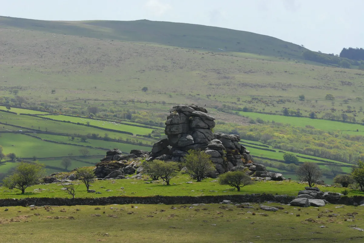
The Ramblers, the British Mountaineering Council and others spent eight years seeking access to Vixen Tor after landowner Mary Alford erected barbed wire in 2003. Alford claimed there was no legal public right of way. A planning inspector found that, although evidence showed people had visited the tor, there was insufficient evidence to show they had used it for the required period of 20 years. The public were ruled to have no right of way.
