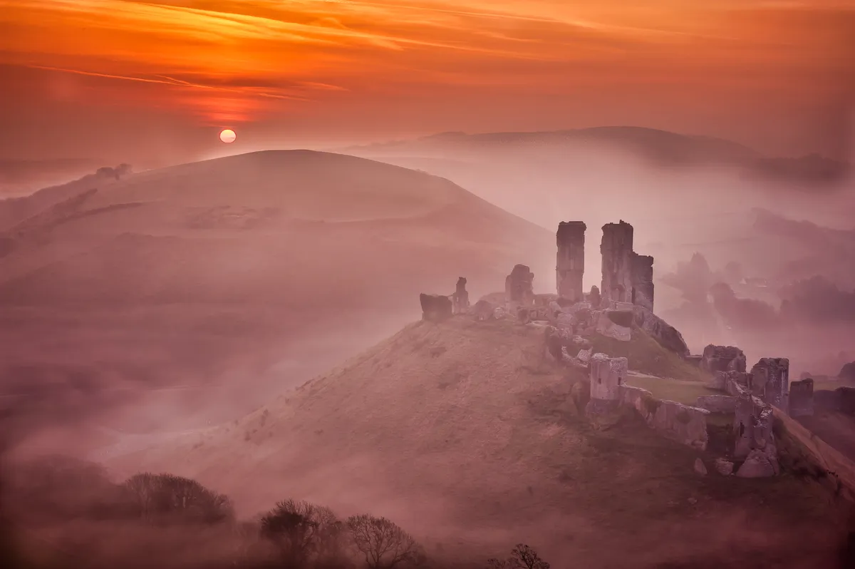
River, road and railway thread their way through this gap in the rolling chalk Purbeck Hills, beside the hilltop Corfe Castle that has given its name to the village – both built of grey Purbeck limestone.
And it’s the castle you’ll notice, dominating the skyline since 1068, when William the Conqueror created one of England’s first stone castles. It remained in royal hands until sold by Queen Elizabeth I. Today it’s looked after by the National Trust.
- Best walks in Dorset
- Britain’s most impressive castles
- Step into a world of Vikings, Normans and clan chieftains with these 10 must-visit coastal castles

Corfe Castle walk
0.9 miles/1.5km | 45 minutes | easy | 40m ascent
1. Start
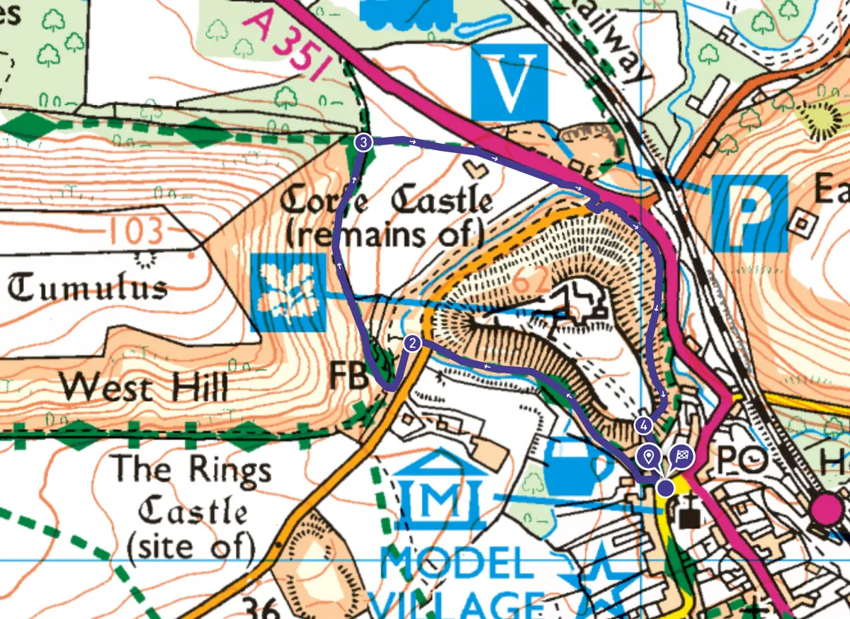
Head past the National Trust tearoom down Ollie Vyes Lane. To the left is Corfe River, banked by ferns and lichen-encrusted trees. Listen out for Dartford warblers, waxwings, choughs and possibly the castle’s ravens. Looming above on the right are the tower, wall and turret ruins, destroyed after the Civil War. In olden days waste from its toilets ran into the river.
After a stone bridge on the left there’s a wooden gate. Cross the road, through another gate, then cross a footbridge.
2. West Mill
By the remains of the 16th-century West Mill, and nearby picnic tables, is the perfect spot for a welly-paddle, or venturing onto the stepping stones, as the river curves, acting as a moat.
Head left through a wooden gate, turning right through the next, signposted Purbeck Way, Corfe Castle and National Trust Visitor Centre. Shortly afterwards is a stone waymarker saying ‘Wareham Rd ½’.
The grass soon becomes a rising, narrow, stony chalk path, with brambles and hawthorns.
3. West Hill
As you approach the gate and signpost there’s an optional climb up West Hill: turn sharp left onto the chalk path angling steeply upward. It’s narrow, with loose stones, not suitable for pushchairs or wheelchairs. Reaching a gate, turn right, following the fenceline to the peak. At the top, you’re looking down on the castle and can imagine its original layout. To the east is Poole Harbour, the world’s second-largest natural harbour, then Bournemouth beyond, and the open sea.
Retrace your steps down to the main path, where you can watch steam trains puffing through the gap in the hills. ‘Corfe’ derives from Old English ceorfan, meaning 'a cutting'.
Cross the field on the right, to the left of the barn, and through two gates to the pavement. Through double wooden gates a path (not suitable for pushchairs/wheelchairs) curls around the castle hill, avoiding the busy road, to the castle gate.
4. Castle gates
To the right, water gushes down the stepped sluice of the channel that turned the waterwheel of a former mill. As East Street joins the square you’ll see St Edward’s church, named after King Edward the Martyr. He became king in 975 aged 12, and was murdered near the castle in 978 by his stepmother Queen Elfrida to put her son Ethelred (the Unready) on the throne. There’s a commemorative sign across the square.
Corfe Castle map
Corfe Castle walking route and map

Useful information
Starting point
The Square, BH20 5EZ. Bus 40 (morebus.co.uk). Swanage Railway (swanagerailway.co.uk): steam/diesel trains, from February 2024. Parking: National Trust car park (free for NT members; £2 1hrs, £5 4hrs). Free small car park across road. West Street car park (Holland Close, BH20 5EB), £1 1hr, £2.20 3 hrs).
Terrain
Fairly level going, on roads, pavements and footpaths, with optional climb. Several gates. Suitable for wheelchairs/ pushchairs, except optional detours.
Map
OS Landranger 195; OS Explorer OL15
Eat/drink
Village Bakery in square: pasties, sandwiches, sausage rolls and cakes. National Trust tearoom: cream teas, cakes, hot chocolate, tea and coffee. Several pubs including Greyhound Inn (pizzas, milkshakes, open fire).
