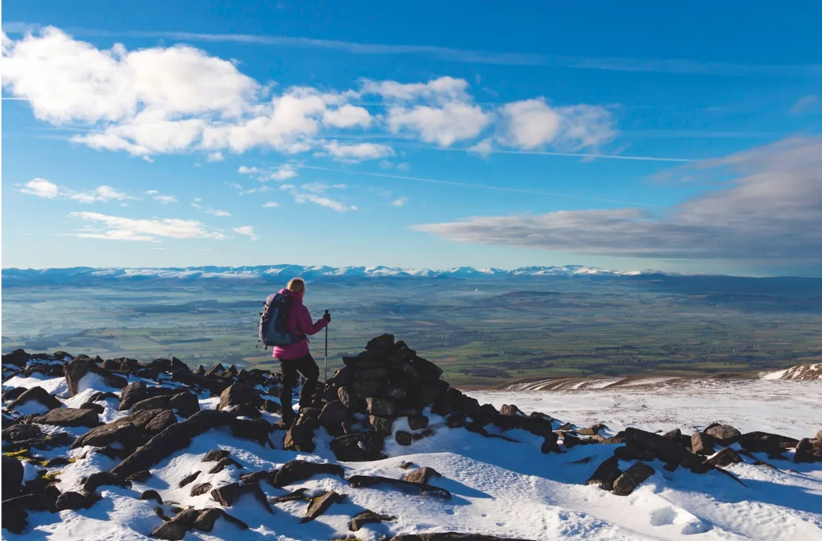
Broad-based, bulky and cold, Cross Fell is a far mightier peak than you may think on first glance.
It proudly holds the title as England’s highest point outside of the Lake District, and once you’ve clambered up to its rocky summit and looked west towards that teeming sea of fells and valleys, you’ll appreciate what an epic viewpoint it can be in clear conditions.
That’s assuming you get clear conditions, of course. The Pennines – a rough spine of rock running through the centre of the country – tend to draw weather to themselves with a grim and inevitable magnetism.

If there’s snow in the sub-Scottish hills, the chances are some of it will have fallen here. Ask many of those who have completed the demanding 267-mile Pennine Way in its entirety, and the likelihood is that their most dramatic tales from the trail will feature this 893m summit.
However, don’t let any of this put you off – if you’re looking to strengthen your legs and heart, then there are few arenas more suitable. And, more than that, if you can comfortably make your way around and across Cross Fell’s slopes in all the varied conditions it has to offer, then you’ll have more than just walking fitness: you’ll have mountain toughness, too.
Cross Fell walk
8.2 miles/13.2km | 5-6 hours | challenging
There are plenty of ways to approach the peak, with the small yet well-catered village of Dufton to the south being an obvious base for your visit. Many make their ascent via the waymarked Pennine Way, up to Knock Fell, over Great and Little Dun Fells and on to the impressive dry-stone shelter that marks the summit of Cross Fell.
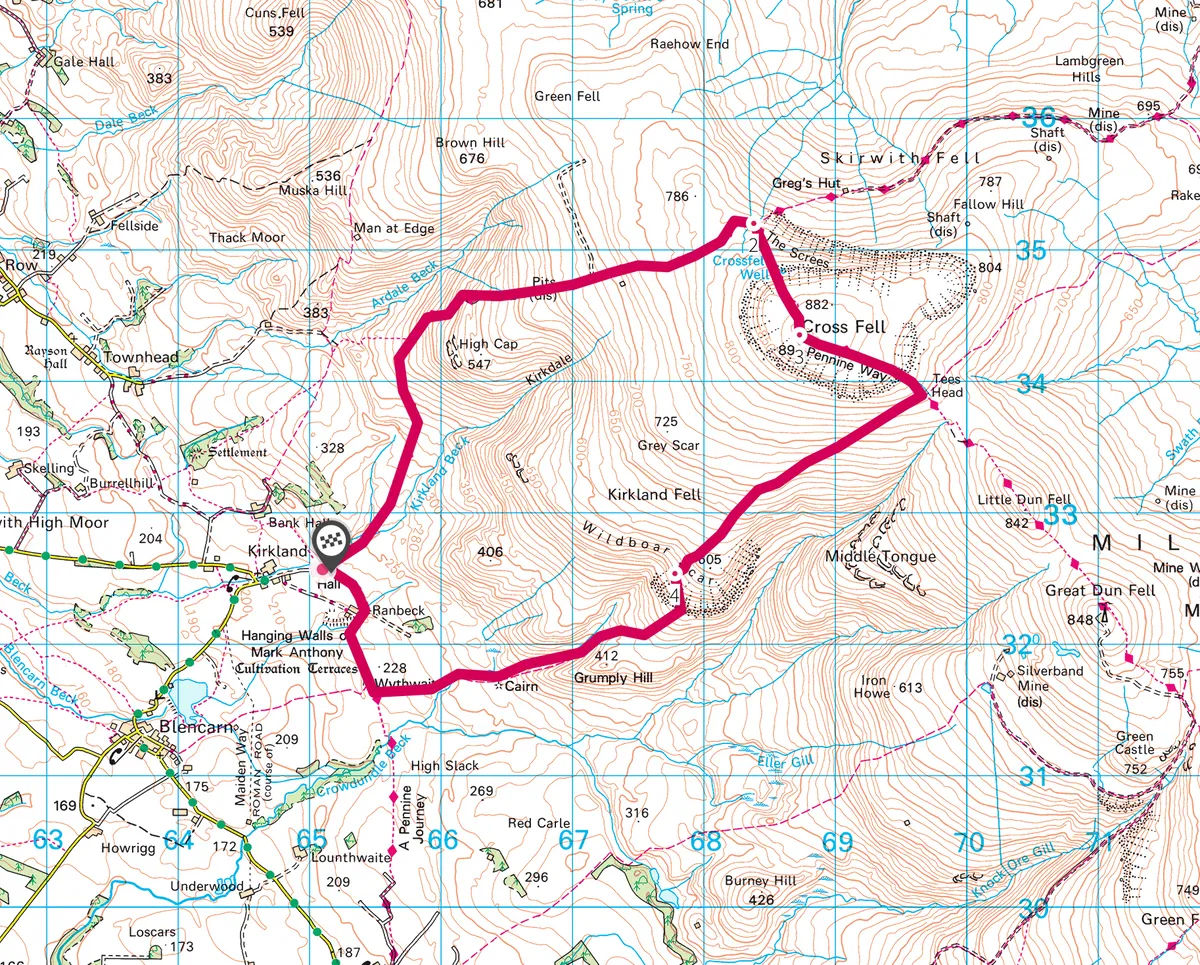
However, this route requires a long return journey back to civilisation or a night in the bare and basic bothy of Greg’s Hut on the mountain’s northern side. Instead, try our challenging and rewarding circular walk, ascending steeply from the west.
1. Slopes of scree
Here, the path turns south-south-east towards the mountain’s rocky summit. A necklace of shattered scree surrounds its upper limits.
2. High Vistas
The cross-shaped dry-stone pile at the top can provide some welcome relief from the wind, no matter which direction it’s approaching from. Given even a hint of clarity you should be able to enjoy some superb views over to the Lake District and into the bleak, empty quarter of the northern Pennines. Make your way south-eastward to Tees Head and turn south-west to descend back into the valley via the rougher ground of Wildboar Scar.
3. Back to the valley
Once you’ve made your way past the Scar, follow the track that runs just north of the pleasingly titled Grumply Hill to return to the valley bed just south of Kirkland and your starting point.
Cross Fell map
Cross Fell walking route and map
