Overlooked by Rhossili Down, Rhossili Bay is a bare sweep of sand, rinsed clean by icy surf and cradled between two craggy limestone tidal islands called Burry Holms and Worm’s Head. They creep like fingers into the Atlantic Ocean, buffeted by its ship-wrecking winds. The timbers of The Helvetia, a Norwegian vessel driven onto the sand in 1897, are still exposed at low tide, stark as old whale-ribs.
According to tradition, Burry Holms is where St Cenydd was washed ashore in a currough and raised by seagulls, before going on to found a 6th-century Celtic Christian monastery just inland. To the south, Worm’s Head was named by the Vikings – wurm being Norse for dragon or serpent – and from Rhossili Down it does indeed look like a sinuous monster swimming out to sea. Crabs and lobsters are still dumped by the tides into holes of the Worm’s rocky causeway, pocked and riddled by the relentless sea.
There are plenty of walking options around Rhossili; to Worm’s Head at low tide perhaps, or along the Wales Coast Path north to Burry Holms.
Or you can try this linear cliff-top walk from Rhossili Bay south-east to Paviland Cave.
On reaching the cliffs above the cave, it is important to exercise caution – even at low tide the water may not be low enough to safely reach it. The cave is only safely accessible in dry conditions for one hour either side of a low spring tide, and involves a potentially dangerous scramble up the rocks.
Looking for more outdoor inspiration? Check out our guides to Britain's best coastal walks, the great beaches for fossil hunting and beautiful beaches to visit this year.
Best walks in Wales
Discover 30 of the best walks in Pembrokeshire, the Brecon Beacons, Snowdonia and more stunning landscapes with our round-up of Wales' most spectacular walks.
Rhossili Bay to Paviland Cave walk
7.8 miles/12.5km | 5 hours | moderate | 314m ascent (return)
1. Start
From Rhossili head towards Worms Head (Pen Pyrod) enjoying expansive views of Traeth Llangennydd while ponies – testament to commoners’ rights dating to at least the Iron Age – crop the wayside grass.
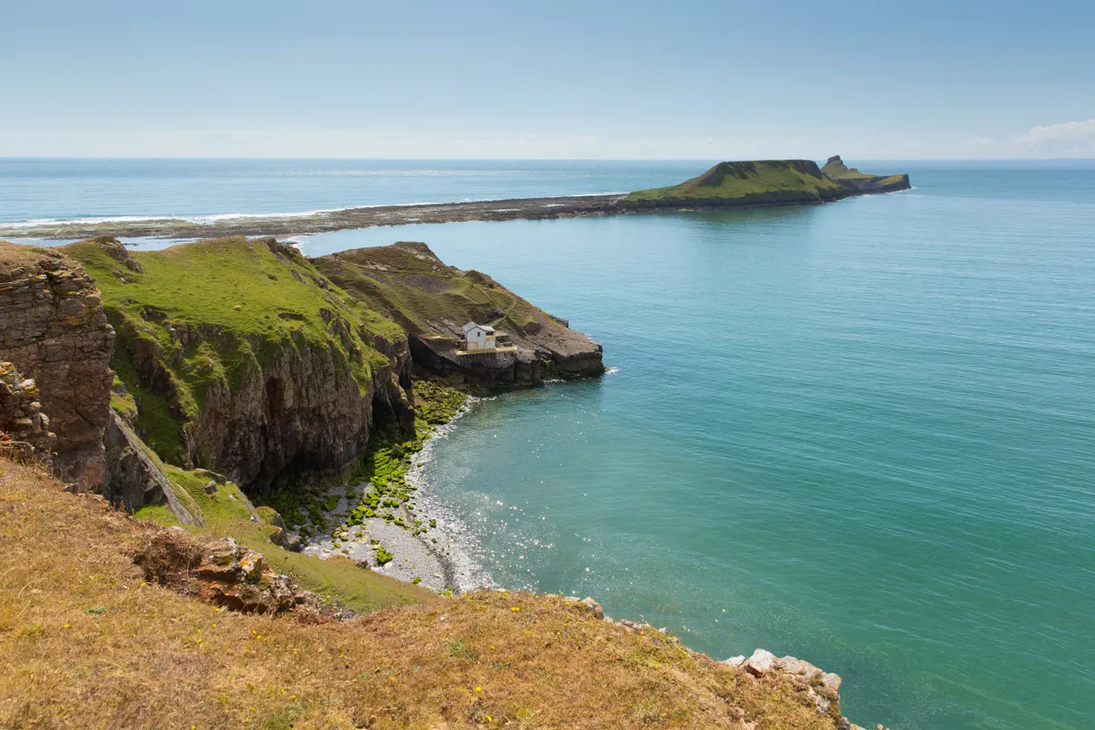
2. Lookout Station
At the National Coast Watch station, bear left to cut the corner of the headland on the coast path, noting the medieval strip fields inland. The underlying limestone supports and nourishes a range of vegetation including common rock-rose, spring cinquefoil and squinancywort.
Credit: CufflinkssHD
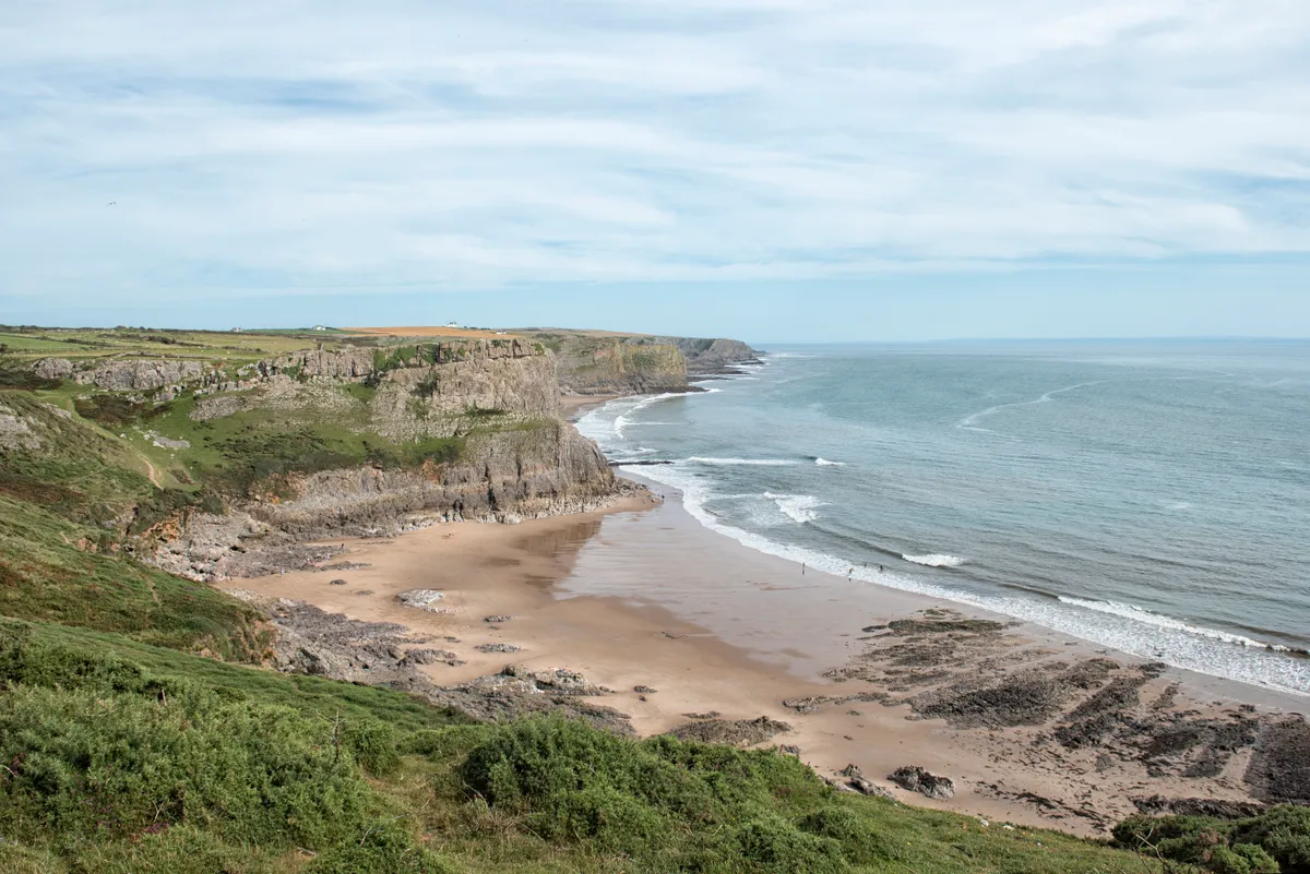
3. Fall Bay
Fall Bay lies in a limestone arena – limestone which formed under a shallow sea of corals and brachiopods. Subsequently, a mere 120,000 years ago in an inter-glacial, the limestone was sculpted by melting ice.
4. Mewslade
Approaching Mewslade, the cliff-scape becomes ever more spectacular, extending into pie crusts, flouncing at the base, stricken with stripes, bashed into caves; there are caves down at Mewslade, too, which are reachable at low tide.
5. The Knave
The Knave is a prominent headland, a shark fin of rock. It is also the site of an Iron Age promontory fort – one of several defended enclosures in the area, where families once lived.
Britain’s most stunning coastal walks
Explore the UK's shores with our round-up of the islands' most spectacular coast walks.
6. Deborah’s Hole
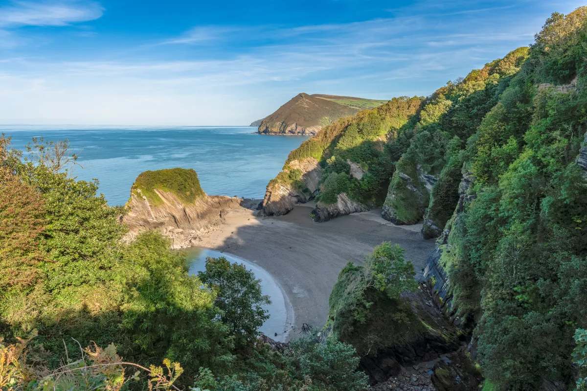
Even earlier peoples dwelled in the caves. Deborah’s Hole yielded finds of Stone Age tools. Meanwhile, remains of Ice Age animals like mammoths, woolly rhinos, and Irish elks, straight-tusked elephant, hippopotamus and rhinoceros have been discovered nearby.
Paviland Cave
Slung out on the south-western reaches of the Gower Peninsula, Paviland Cave (or Goat’s Hole) is just visible as a dark blot in the rock on the cliff face.
Conditions were even wetter back when the cave was formed by sea that was 8m higher than today. Conversely, when Paviland Man was buried in it some 28,000 years ago, the cave was high and dry, overlooking a plain. ‘Paviland Man’ ate fish, meat and grain, and lived when the Bristol Channel was a shallow meandering river, when the edge of the ice was an hour’s walk away. His is the oldest known ceremonial burial in Western Europe.
7. Paviland Cave
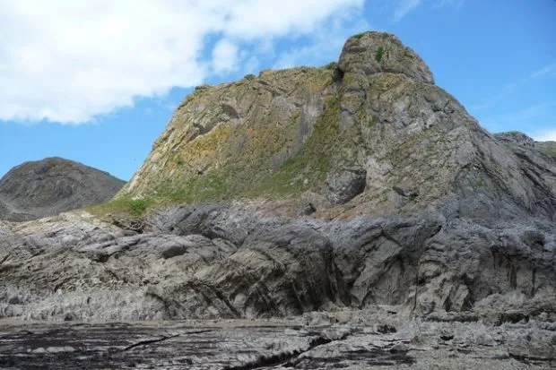
The Paviland promontory in which Paviland Cave (Goat’s Hole) is secreted, punches the sky like an arthritic fist. To reach it, descend to the shore platform down the slippery gully on a very low tide, and carefully scale the rock to the cave.
To return either retrace your steps, continue to Port Einon, or follow the path inland to Pilton Green and pick up the bus. A replica of Paviland Man is in Amgueddfa Abertawe (Swansea Museum), which is well worth a visit.
Paviland Cave map
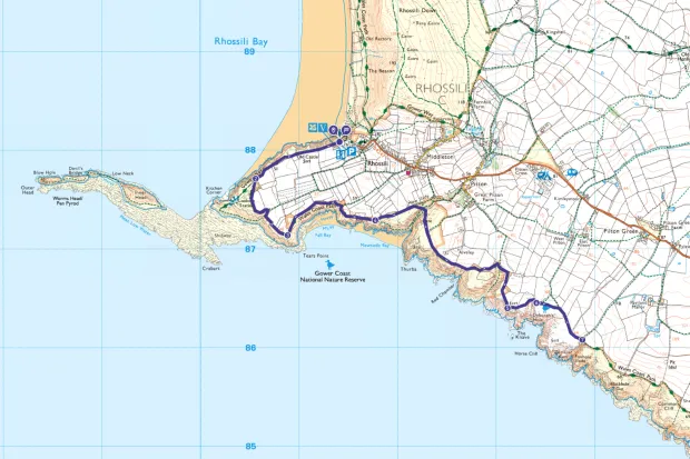
Rhossili to Paviland Cave walking route and map
Useful information
Starting Point
The National Trust car park at Rhossili, SA3 1PP - £6. Roads are congested. The 118/119 bus from Abertawe (Swansea) allows you to end in Pilton Green.
Terrain
This narrow undulating coast path is rough underfoot. The approach to the cave involves rough ground and very slippery rocks.
Map
OS Explorer 164
Cave Access
Pavilion Cave is only safely accessible in dry conditions for one hour either side of a low spring tide, and involves a potentially dangerous scramble up the rocks.
Eat/drink
The Lookout in Rhosili is a simple café serving great savoury treats and excellent chocolate brownies.
