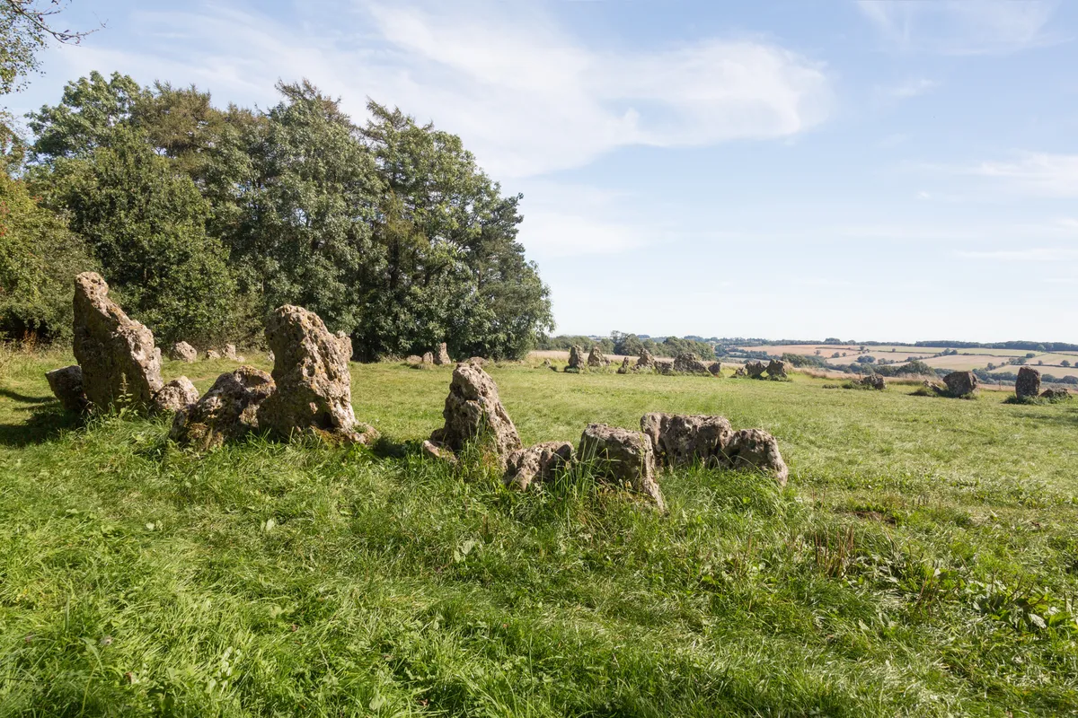
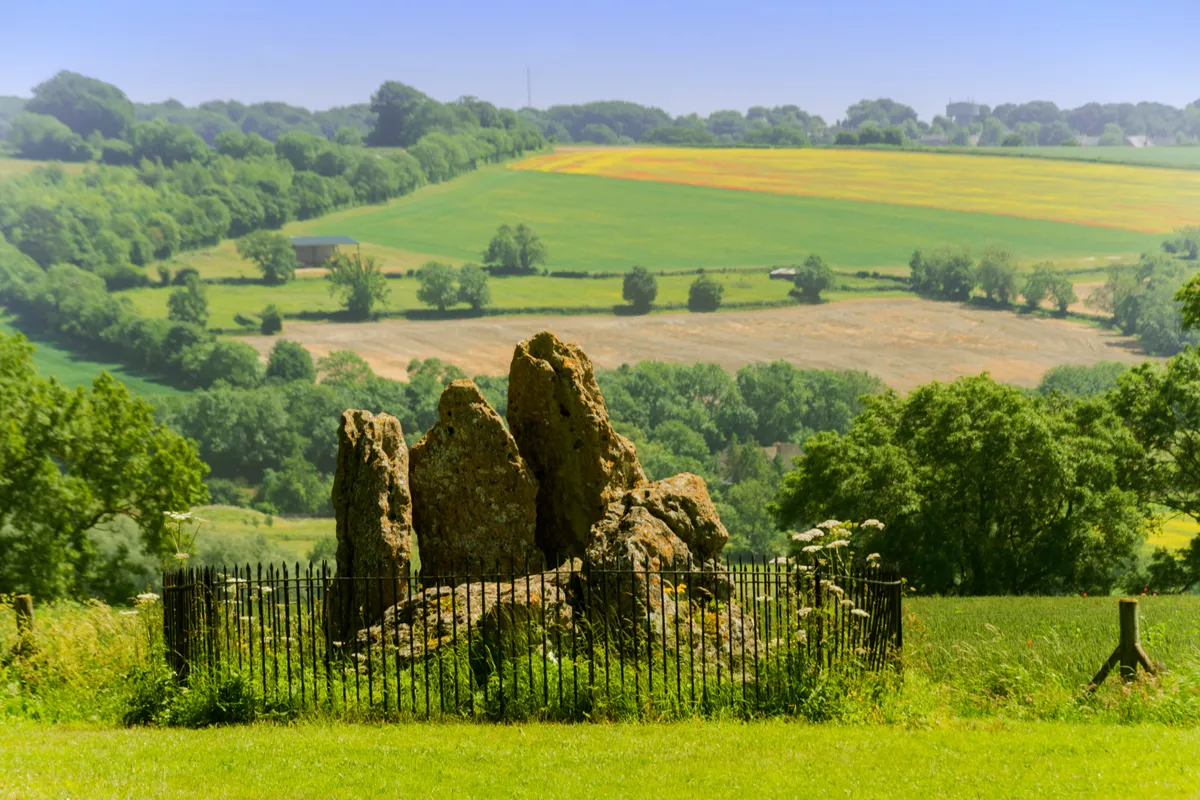
The Rollright Stones are made up of three manmade groupings of heavily pitted natural boulders, weathered into outlandish shapes by millennia of wind and rain.
All three sites are within a couple of minutes’ walk of each other.
The route here is a fine loop walk that leads up through open farmland from the village of Salford, with the Rollright Stones encountered midway through. Say what you like about the legends attached to the place, but the boulders’ strange, hefty presence makes this a special spot.
Looking for more routes in Oxfordshire? Try our walks at Uffington White Horse, Henley-on-Thames and Abingdon Lock.

Rollright Stones walk
4.7 miles/ 7.5km | 3 hours | Moderate | 120m ascent
1 . Start
Beginning the walk at the green in Salford, bear left along a tree-flanked lane, past a sign for Rectory Farm. Continue ahead, as fields open up. Ignore a right turn-off towards a private lake, continuing instead to reach a small gate in a bend in the hedge.
2. Stream crossing
Go through the gate and turn right. Keep the hedge on your right until seeing, on the left, a clear track through the field. Take this and follow it through more fields – sticking to the path as it kinks left and right and brooks a small stream – before reaching a minor road.
3. Field crossing
Cross the road then continue ahead, following the path straight across the next field. Go through another gate and keep on the signed footpath as it climbs uphill. Stay on this until a gate in the gap in the hedge on the left, leading towards a grand farmhouse.
4. Rollright Stones
Passing through the gate, follow the field edge, then at the next gate climb diagonally to cross in front of the farmhouse. Continue past the farmhouse and barn, before soon reaching a grassy avenue through the woods on your left. Follow this until crossing a stile into an open field. The Whispering Knights will be visible on your right. Head off to visit the Rollright Stones (take care when crossing to the King Stone).

5. Little Rollright
Having explored, retrace your steps to the stile in Stage 4, then turn right to follow the footpath across field. This is the D’Arcy Dalton Way, which will lead you back to Salford. Signage is reasonably good and the route is almost wholly straight. Re-cross the minor road and follow the path, passing the hamlet of Little Rollright, sticking to the clearest path throughout, via various gates.
6. Salford
You’ll pass through two atmospheric patches of woodland. Stay on the path as it winds through the first trees, eventually crossing a stream. The path then shifts from one field edge to another before the second patch of woodland. After woods, you’ll pass Rectory Farm on your left before rejoining the earlier path into Salford.
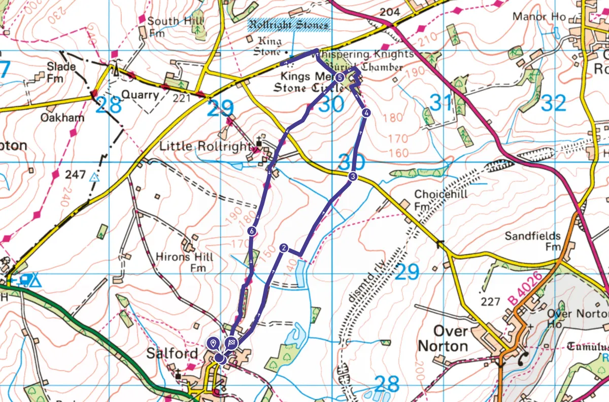
Rollright Stones map
Rollright Stones walking route and map

Useful information
Starting point
The green in Salford, at junction of Cooks Lane and Roses Lane (OX7 5YY). From the A44, head past the (closed) Salford Inn and along Cooks Lane for 300m until reaching a grassy playground. Park here considerately. There’s no public transport to the village.
Terrain
Variable. Grass, stiles, stream crossings, sections of uphill. Generally fine for experienced walkers but not wheelchair-friendly. Warning: can get very muddy!
Map
OS Explorer 191
Eat/drink/stay
Chipping Norton is a five-minute drive from Salford and has plenty of places to eat and stay. The Fox is a good pub for local Hook Norton beers.
